Digital Atmosphere Workstation Patch V1.0i is now available at:
http://www.weathergraphics.com/download.htm
Changes from V1.0h to V1.0i (6/15/04)
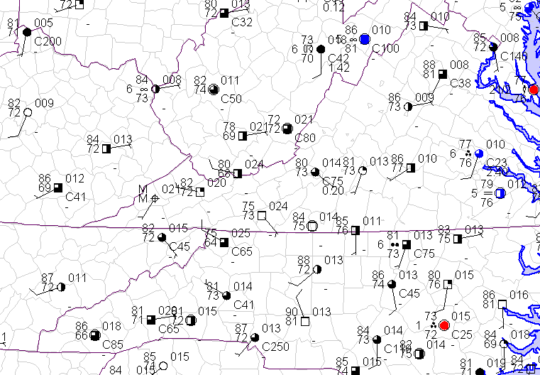
* PRECIPITATION. Precipitation from observations now fully supported. Instead of being carried in one variable, variables are now provided for the full range of precipitation times (1, 2, 3, 6, 9, 12, 15, 18, and 24 hr) so they can be plotted and analyzed independently. Contour codes now added for these (PC01, PC02, PC03, PC06, etc) and a new precipitation menu has been added (reflected in digatmos.mnu). A trace of precip is always treated as 0.1 mm (the difference is like splitting hairs anyway). The internal unit of measure for precipitation in Digital Atmosphere is tens of mm, and -9 means zero precipitation while -9999 means missing precipitation. Note that there are some difficulties due to poor coding standards: for example in METAR there is no way to differentiate between a station that observed zero precipitation and one that does not even encode precipitation, so in METAR it is always assumed zero precipitation was observed if no precipitation group was carried. This could affect the contours, but I have no idea about what else to do. SYNOP should behave appropriately since the iR group says explicitly whether precip is not observed or is simply zero.
* MM TO INCHES CONVERSION function MMIN is provided and is used in the new precipitation menu (which uses English measures by default, though the original data is stored internally in tens of millimeters).
* QUALITY CONTROL PANEL has been changed to allow the new precipitation variables to be viewed and modified.
* CONTOUR LABELS now allow decimal fractions, depending on the contour interval that is set. This allows labels like 0.05, 0.10, 0.15 (inches), etc.
* ANALYSIS MENU does not produce extra 'blank' selections anymore when dead carriage returns are entered in the digatmos.mnu file.
* CONTAINS THE TWO MISSING SKEW-T FILES (skewblnk.bmp and skewblnk.cfg) that were accidentally omitted from Tuesday's v1.0h build.
NEW PATCH AVAILABLE -- V1.0i (Precipitation, etc)
-
Tim Vasquez
- Administrator
- Posts: 534
- Joined: Sat Nov 22, 2003 10:47 pm
-
Wally Mayo
- Senior Member
- Posts: 254
- Joined: Thu Feb 05, 2004 11:36 pm
- Location: Roanoke, VA
- Contact:
Speaking of the QC panel, the "remove last product" menu item under WINDOW in DA sure was nice.
For example:
If using scripts (auto or on the fly manually)...
say you already have ASUS01 fronts plotted along with radar, and surface plots are being fiddled with using QC. In order to replot corrected item(s), you have to do ERASE -
Of course, on the map, you lose everthing done before. (it's possible , though cumbersome to "copy marking onto map and save" before the ERASE-at least compared to a quick remove last item and replot)
In order to get fronts down first (yeah, radar CAN be added last, but that adds yet another step and it will look slightly different) if they (fronts) are imported again, then all changes to surface plots are lost, for they will have to be imported anew.
There are other cases of clear advantage to having "remove last product."
Maybe I'm just spoiled to having it before. Just a suggestion.
BTW - it's GREAT to have you back on the forum. (We knew you were "occupied" though)
-
Wally Mayo
- Senior Member
- Posts: 254
- Joined: Thu Feb 05, 2004 11:36 pm
- Location: Roanoke, VA
- Contact:
