Yes, the two projections do match "fairly" well:) That is the biggest pain finding satellite imagery that everybody has access to (without needing to use other software)." wrote:Ok, once I found the Navy site, I "tweaked" several maps (US, tropics, east).
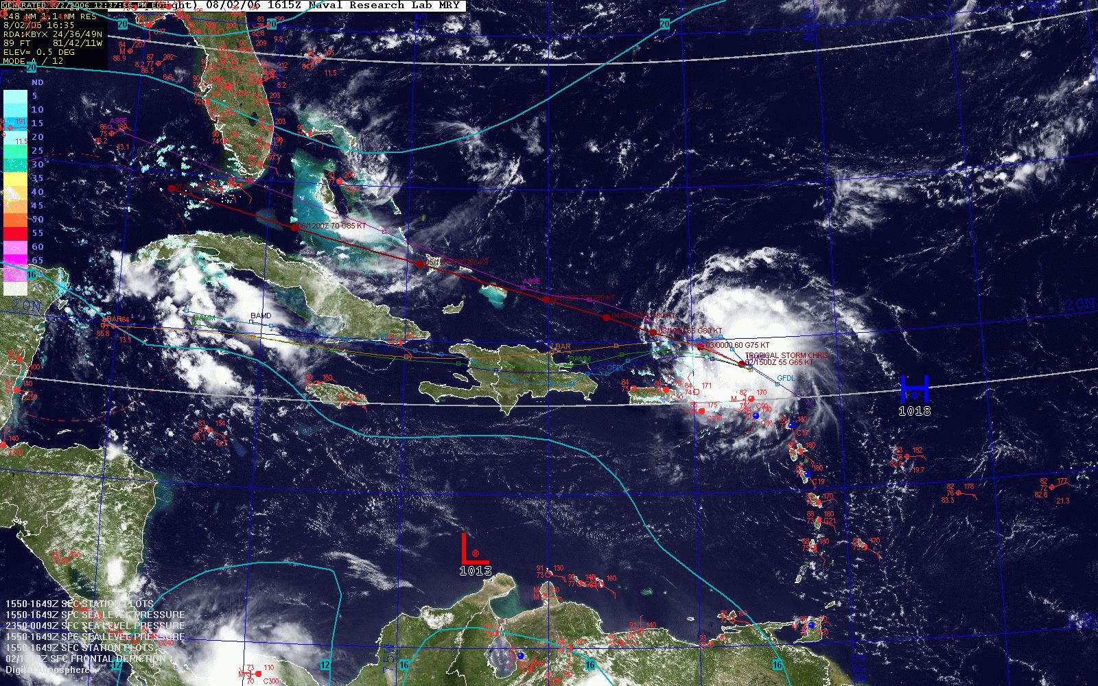
Here is a tropics overlay...
http://www.weatherroanoke.com/tropics.jpg
Still working out colors, though.
And, I would appreciate any other maps/combos!
Feel free to share the values you entered for the US overview map. I've always had a heck of a time getting that one to fit exactly in DA WS - even though the projection isn't all that different.
Pat