Page 3 of 3
Posted: Tue Apr 20, 2004 11:29 am
by Wally Mayo
I imagine this is on the fix list ... I know this was mentioned back in about 1.0d or so, but...
smoothing passes don't happen. 1 or 7 passes makes no difference (at least as tested with "nearest neighbor."
Posted: Wed Apr 21, 2004 12:58 pm
by Wally Mayo
Can there be a filter (check box) to exclude radar plots that are in clear air mode? (Does the digital code have a flag or header info that the data is in clear mode?) I know we can select and deselect the stations manually, but that takes a bit of tending over time. And even in non-script usage, sometimes one has to go back and deselect a station and re-get data to avoid the nice big orange/pink "splat" on the screen.
Posted: Fri Apr 30, 2004 3:03 pm
by Wally Mayo
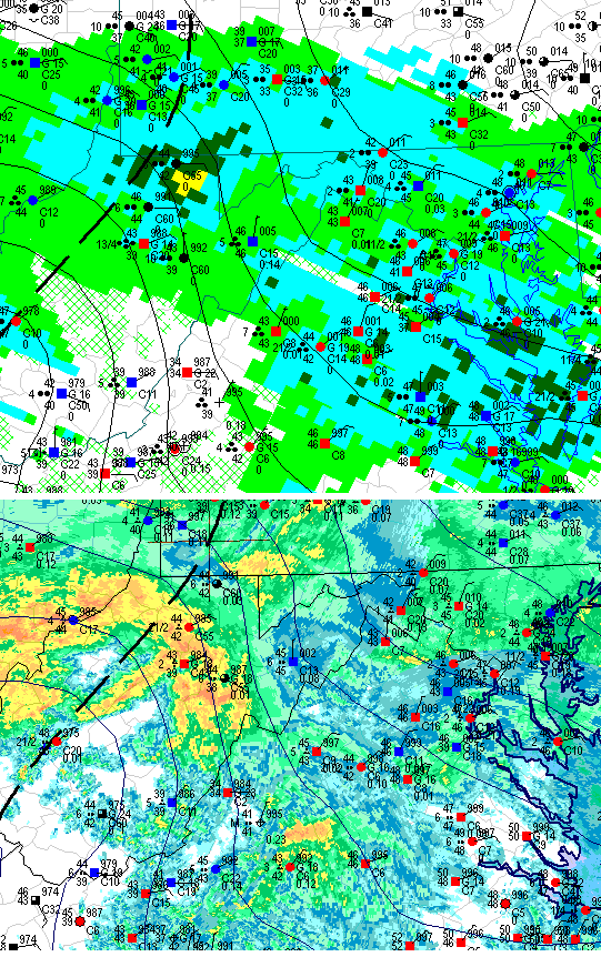
I know I've mentioned this before - about the weather symbols not working well at smaller sizes. Here's a comparison for similar maps with DA and DAWS - BOTH using a 9 point font for the station info.
Radar detail has some impact, but see how much more readable the wx characters are on the whole with the DA rendering. The four dot rain now has connections.