


Digital Atmosphere is a powerful weather forecasting program that allows
you to create detailed maps of real-time weather for anywhere in the world.
It makes extensive use of techniques and algorithms that are comparable
and in some cases superior to the National Weather Service's multimillion-dollar systems.
It runs on any Windows system,
and uses free data from government and university sources on the Internet. Digital Atmosphere Historical
Data is now included as of version 3.06!
Starting in 2021 Digital Atmosphere began ingesting full-resolution model data directly from NCEP.
This allows GFS, NAM, HRRR, and even GDPS/RDPS data to be displayed!
Try out a copy!
You can download a fully functional program and use it for 30 days to test out
its capabilities. If you like it,
register and we will send key numbers to keep the program functional past the
30-day evaluation period. Registrations are processed manually and you will receive an email with instructions on how to obtain your key within 3 days of your order.
» Download Digital Atmosphere
Types of data supported
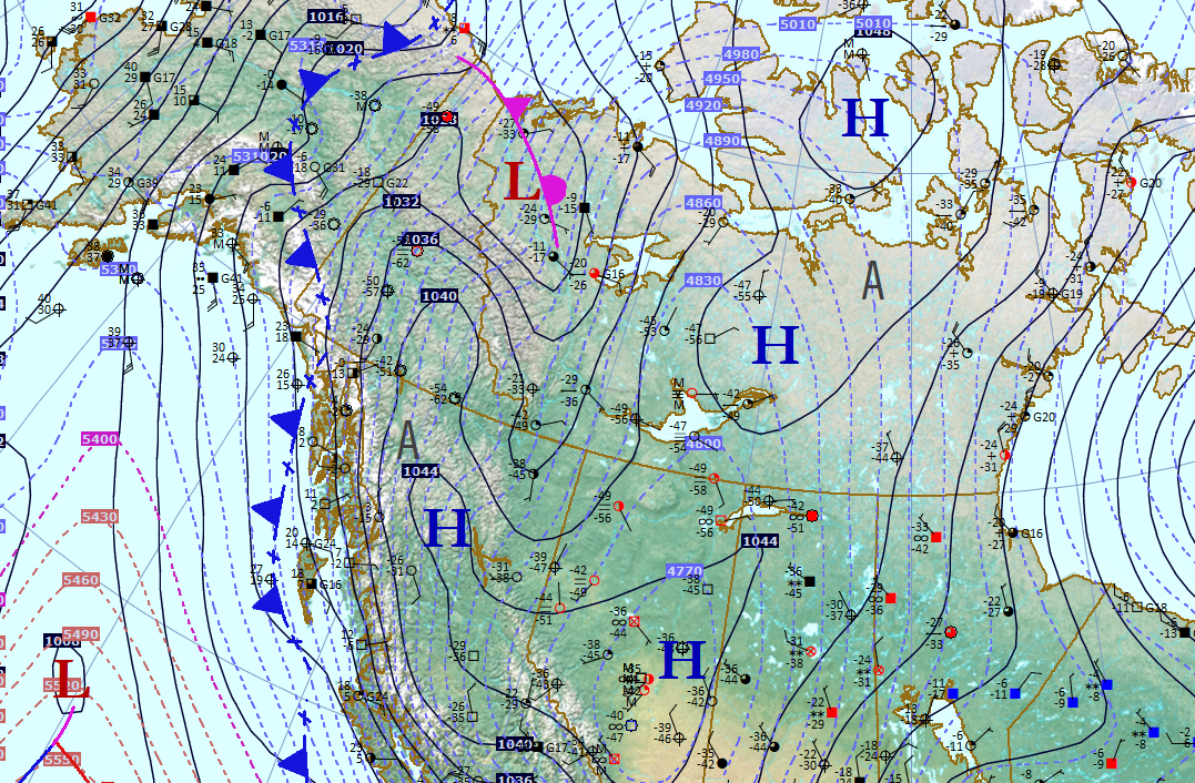
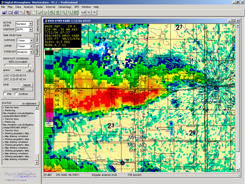
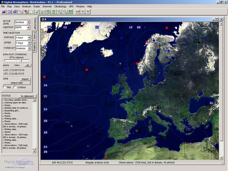
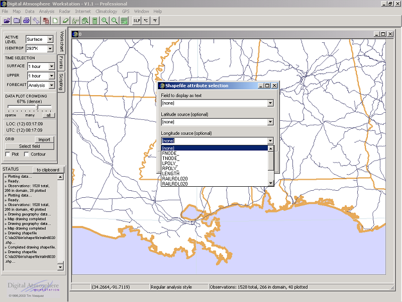
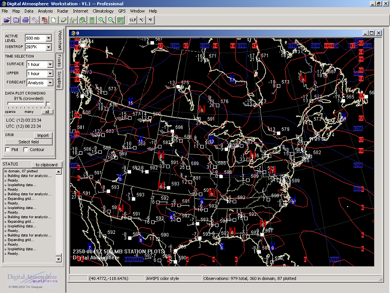
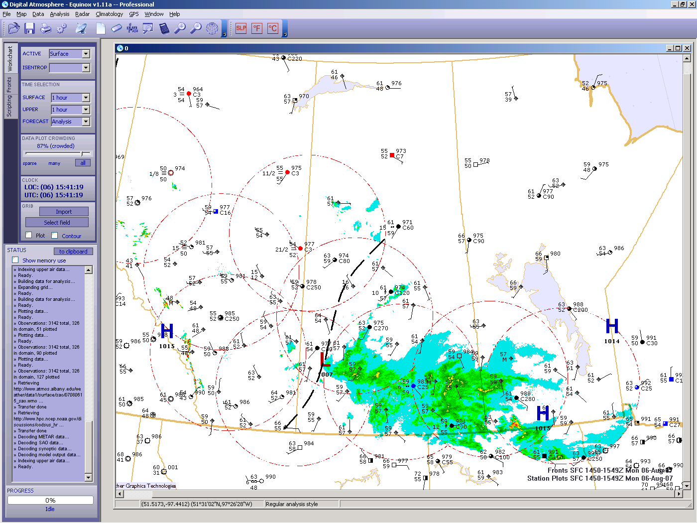
Digital Atmosphere imports and displays land synoptic (WMO FM 12 SYNOP), ship synoptic (WMO FM 13 SHIP), METAR (WMO FM 15 METAR), buoy (WMO FM 18 BUOY), upper air (WMO FM 35 TEMP), aircraft data report (ACARS) (WMO FM 42 AMDAR), NMC frontal depiction transmission format (ASUS1 KWBC), gridded binary (GRIB) (WMO FM 92-IX), NEXRAD Level III (ICD 2620001) WSR-88D NEXRAD format, Australian AXF comma-delimited observational data and similar formats, NHC Hurricane Warning bulletins, any weather agency's radar images available on the web (JPG or non-animated GIF; configuration may be required), and more!
Companies and agencies using Digital Atmosphere
A partial list of corporate, military, and institutional users of Digital Atmosphere has included Salt River Project, Idaho Power Company, FedEx, numerous television stations, Northland College, University of North Dakota, SUNY Brockport, University of North Carolina, Emory University, Mississippi State University, Hankuk University of Foreign Studies in Yongin, South Korea, numerous National Weather Service offices, NOAA Air Resources Laboratory, USGS Water Resources of Indiana, Munich Meteorological Institute, Weizmann Institute of Science, the national weather services of Italy, Netherlands, Switzerland, and Cyprus, UKWtechnik Electronic GmbH, Mobile Weather Information Systems GmbH, Skycom Telecom, Zephyrus Communications, SeaScan International, DTN Weather Services, Meteorlogix, The Weather Network, Meteo WVL, T-Storm Weather, 3 ASOS (Eielson AFB), US Navy NAVEURMETOCCEN, US Navy NAVPACMETOCCEN, US Navy NACPACMETOCCEN, Maritime Warfare Centre, Naval Technical Training Unit Keesler, Colt International, ABX Air, WNI Oceanroutes, Fugro GEOS, Oceans Limited, Upper Dublin High School, Erik Ramstad Middle School, and Woodward Academy.
Questions and answers
What kind of raw data does Digital Atmosphere accept?
It uses almost every conceivable format established by the World Meteorological Organization. These include SYNOP, SAO, METAR, PILOT (TTAA/TTBB/PPBB), NIDS WSR-88D data, and more! All of this data is accessible for free (it's on the Internet and anyone can get it).
Where do I get the data?
It's taken care of for you! You just check off the kind of data you want on the Internet Retrieval panel and Digital Atmosphere will fetch it for you and import it for instant viewing. You can change or add new URLs at your discretion. You can also use great weather databases such as WSI and AccuData, and any canned (saved) data.
What is Digital Atmosphere Historical Data?
View weather situations going back 87 years with Digital Atmosphere Historical Data! These are complete sets of observations for North America (US, all 50 states, plus Canada, and Mexico) twice a day, at 00Z and 12Z. This provides all known observations, not just a coarse subset of data. This data differs from our premium Global Surface Archives product in a few ways: the Digital Atmosphere version is in a binary format usable for plotting and analyzing in Digital Atmosphere only, there is no coverage outside North America, there is only data twice a day instead of 24 times a day, and it requires Digital Atmosphere 2018 V3.06 or later. As with other datasets, the coverage is sparse in the 1930s and early 1940s due to the limited availability of hourly observations. However the package offers a spectacular look at synoptic and mesoscale details for almost any situation going back to the WWII years. You can download this data free at our downloads page.
What kind of other cool stuff does Digital Atmosphere do?
Digital Atmosphere contains a scheduler for automatically retrieving and redisplaying maps every hour (copies can even be saved to disk). There is a fascinating climatology module that lets you display highs, lows, rainfall, etc for specific cities or plotted on your basemaps. Finally Digital Atmosphere is a great tool for creating basemaps that can be used in web sites, studies, and publications.
Why not just use premade weather maps I can already get off the Internet?
What's the difference between the Standard and Professional Version?
The Professional Version has three main differences:
What's this I hear about topographic maps?
Topography is an essential element of forecasting weather, and Digital Atmosphere features both topography and photoreal terrain.
What kind of system requirements are there?
All you need is a Windows computer (Windows 11/10/8/7) with at least 50 MB of disk space. That's it! Digital Atmosphere is also cleanly written and unlike a lot of software does not populate your system with dozens of nasty drivers, DLLs, and dependencies.
Who writes this program?
The software was written by Tim Vasquez, a former Air Force forecaster and veteran storm chaser. Digital Atmosphere enjoys a legion of grass-roots support because it is a clever software application written for professionals and amateurs alike.
Can I try it for free?
Of course! Our downloadable version is fully functional, and when you register there's nothing else to download or install. You can DOWNLOAD IT HERE.
What happens if I don't register the free version?
Certain features in your evaluation version will stop working after 30 days. You will still be able to retrieve, import, and create maps, but certain features are disabled. These features are restored when you register the software and you get your key; you simply enter it in Help > Register. Your registration is appreciated; not only does it make your copy legitimate but it goes to pay the author's bills. Rest assured you aren't just feeding some corporate bank account.
How can I order? What's the cost?
Just go to the top of this page and look at the ADD TO CART links on the left-hand side. The cost is $89 for the Standard Version and $199 for the Professional Version.
What technical support is available?
Check out our contact page to reach us with comments and questions.
What other support options are there?
For general questions about Digital Atmosphere and other software, visit our online forum. Also read the informative Frequently Asked Questions (FAQ) list.