Your source for forecasting tools, software, and books since 1993
CUSTOMER COMMENTS

"Thank you for actually penning these books. They are a wonderful review of the concepts without the excessive (but necessary) amount of math behind them. I wish they had been recommended as supplements in both my undergrad and graduate years."

— Josh Tobias, 2017

"I have used Digital Atmosphere for quite sometime and consider it to be one of the most straightforward, comprehensive, and operationally useful programs on my server. I have found it to be invaluable for my day-to-day analyses and forecasting as well as my ongoing research. Tim is also extremely helpful and absolutely indispensable when it comes to locating scripts, the best datasets, and even professional contacts to help make any organization as productive as possible."

Chris Robbins, iWeatherNet

"The quality of your products is second to none."

— C. Brian Batey

"Thanks Tim for your quick response (we like that at FedEx) about our Professional Versions! As we're a 24/7 operation, we're look forward to augmenting our present weather system with Digital Atmosphere."

— Mel Bradley, FedEx Operations

"Wow. Your books are incredibly technical and useful. I consider myself a very amateur weather watcher and feel that I am already ahead of the curve. Thank you."

— Terry W. Taylor

"The NEXRAD support is truly awesome and easy to use - and the other feature just really tops it off. This is about my sixth email tonight - the other five being to other spotters in the area telling them they just have to download Digital Atmosphere and give it a serious going over."

— David Cashion

"I'm really looking forward to the next phase of Digital Atmosphere Workstation. I'm sure it will be as excellent as all your other products."

— Simon Keeling
Weather Consultancy Services, UK

"I run and manage a number of festival type events and Digital Atmosphere is able to produce charts that I can use for normal weather forecasting with a fair degree of accuracy and in particular wind speed and direction that is crucial to many of events."

— Robert Connolly, GI7IVX

"The archive data arrived today. WOW! What an amazing set of data! Thanks again for all the extras that you included as well!"

— Bryan Bollman, IA

"We do run GEMPAK and all the Unidata software also, but your package has numerous advantages, the biggest being Windows."

— Anonymous

"I am very impressed with what you have done. I have already shown several people at work your site. I plan on talking to our MIC [Meteorologist In Charge] soon to see if we can get Digital Atmosphere in the office to complement/supplement AWIPS."

— Ken Simosko, NWS, Pocatello

"This new version is even better than the older version which was awesome! Your programming skills and met knowledge amaze me!"

— Chris Kincaid


Hurricane Ida
Before & After satellite imagery

Source: Sentinel-2 / EUMETSAT Image sets by Tim Vasquez / Weather Graphics / Thanks to Shannon Key for programming setup

Due to extensive cloud cover and limited coverage from the orbit on the 30th, this was about all of the usable imagery I could get. It takes 5-6 days to get additional imagery, and could take longer if conditions are cloudy at that time. Nevertheless I'll look at updating this when additional images are available.

Additional sources:
* NGDC Hurricane Ida aerial images - higher resolution but only in specific areas

INSTRUCTIONS: Use your mouse to drag left and right on the slider bar of each image to compare them.


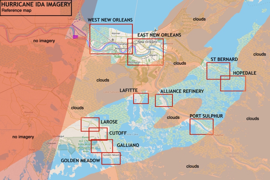
REFERENCE MAP


WESTERN NEW ORLEANS, LOUISIANA
Areas outside the levees are inundated.


EASTERN NEW ORLEANS, LOUISIANA
No major flooding evident in the city. All electricity is out though.


ST BERNARD - SHELL BEACH, LOUISIANA
This area is at the far southeast tip of the New Orleans levee system. The area to the right is Shell Beach.


HOPEDALE, LOUISIANA
Far into the wetlands past Shell Beach is the fishing community of Hopedale (top left). There is evidence of heavy damage from storm surge.


BELLE CHASSE, LOUISIANA PHILLIPS 66 ALLIANCE REFINERY


PORT SULPHUR, LOUISIANA
Port Sulphur is located on the Mississippi River about halfway between New Orleans and Boothville. This area was
about 30 miles east of the eyewall. The south side of the town was obscured by clouds.


LAFITTE, LOUISIANA
This image shows the Lafitte/Barataria area, located on State Rt 3257 about 20 miles south of New Orleans.


LAROSE, LOUISIANA
Larose is located southeast of Houma on State Highway 1, and was within the eyewall. Outlying residential areas (consisting of mobile homes on piers) appear
to have minor flooding. Numerous houses appear to have roof damage, though it is hard to tell at this resolution.


CUTOFF, LOUISIANA
This location is a few miles southeast of Larose, Louisiana on the way to Grand Isle. The images show extensive inundation of the wetland areas.


GALLIANO, LOUISIANA
The Galliano area between Cutoff and Golden Meadow. Looks like minor flooding, mostly protected by the levee system. Unable to tell condition of structures.


GOLDEN MEADOW, LOUISIANA
This view is slightly south of Golden Meadow, Louisiana centered near Leon Theriot Lock
(where levee and canal intersect road). Numerous structures south of the lock are clearly missing.
StreetView looking south from just south of the lock; most of these structures appear to have been destroyed.


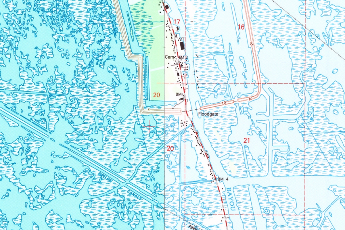
GOLDEN MEADOW, LOUISIANA (USGS TOPO MAP)
Topographic map corresponding to the above image showing the large berms enclosing the South Lafourche Levee District. Maps from 1994. Elevations in feet.