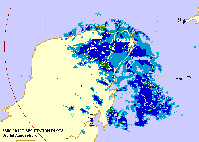
Remember that this is a remap of an image, since virtually all non-US countries do not share their raw radar data. Digital Atmosphere downloads an image, interprets the radar echoes, and georeferences them as shown here. The Mexican EEC radars have good resolution but for some reason their webmasters chose an extremely lossy JPEG format, so this causes some degradation of the image.
It appears Cuba also puts out some good radar images, but they're animated GIFs and I'll have to write code to extract the latest subframe from the image.
This will all be good when the next hurricane rolls around.