Today's route map. Click to enlarge.
Tuesday, June 26, 2001
Hanksville UT - Tonopah NV
Today's route map. Click to enlarge.
|
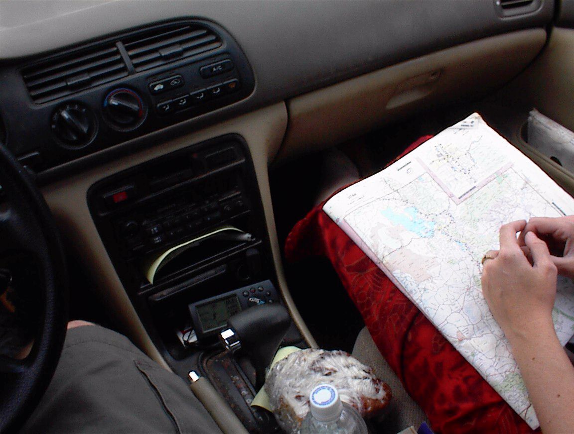
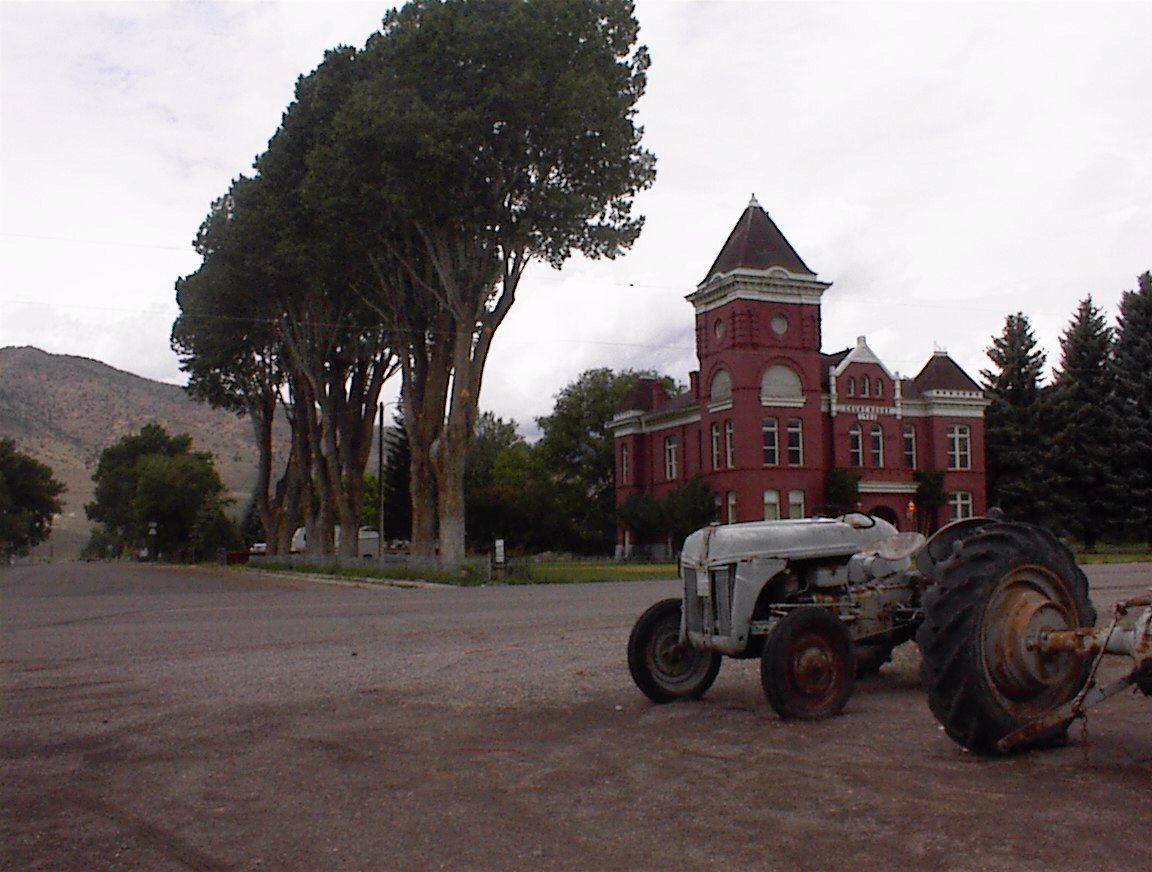
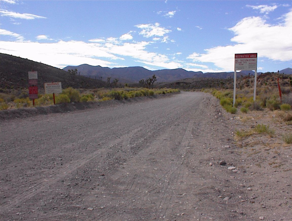
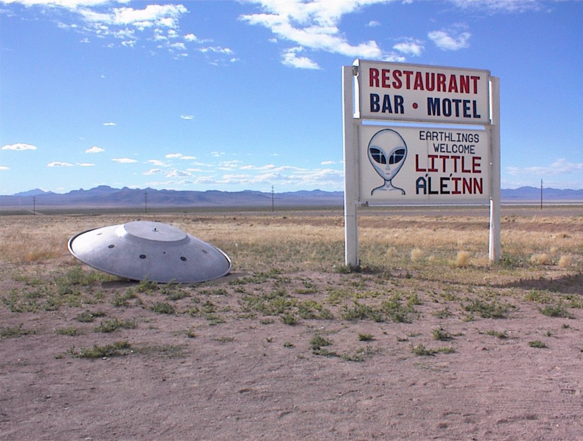
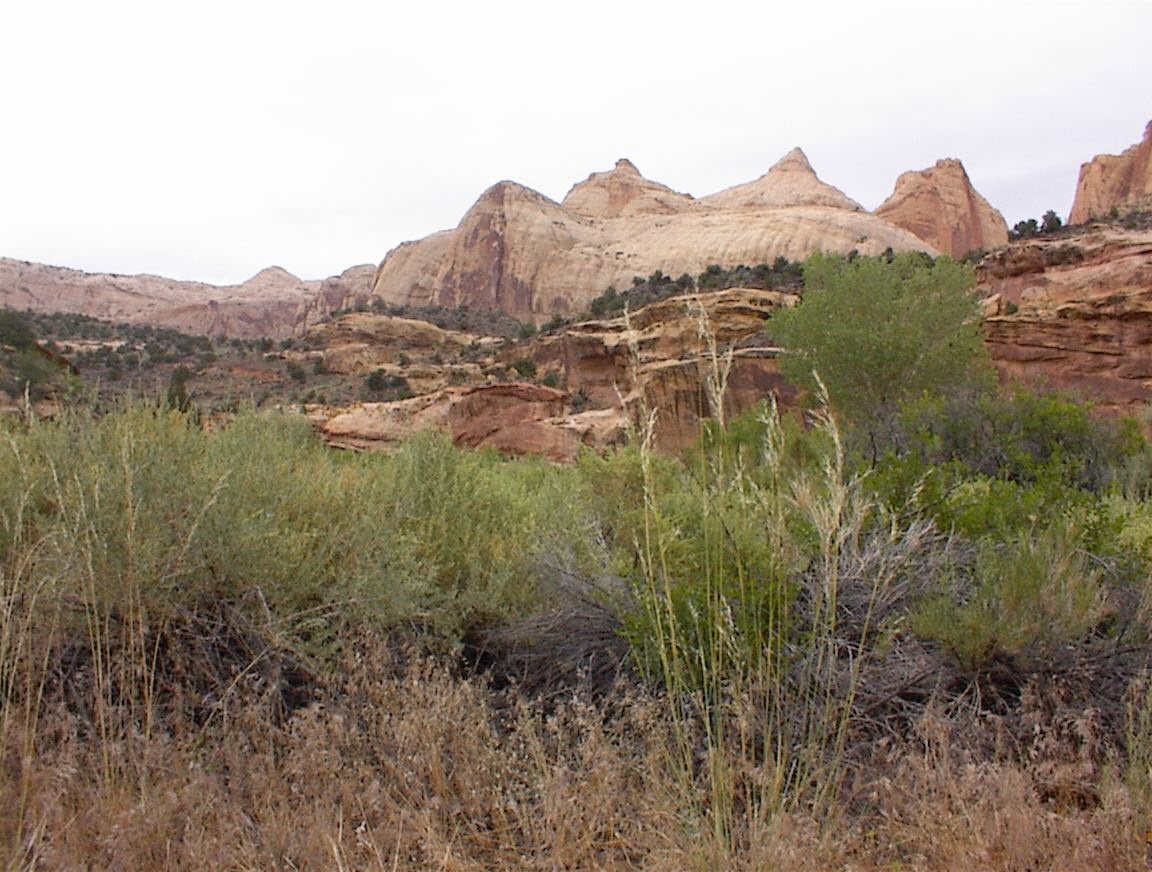
After getting up at 9:30 am it was a quiet departure out of Hanksville at 10:30 am as we accelerated westward. The road followed a miniature series of canyons as it wound towards Caineville, then led into Capitol Reef National Park, which turned out to be a very pleasant surprise rather than just something along the way! The park was filled with huge cliffs of striated reddish sandstone. We had to make a quick stop to check out one of the lava fields. As we exited the park we stopped at a gas station to get some AA batteries and lunch, however the store was out of AA's and the Wendy's next door was closed. We resumed heading west, passing through the town of Torrey, a very trendy town that appeared to have all kinds of "hippie" attractions and activities (we might have to come back and take a closer look). The road took us through the proper and well-manicured Mormon towns of Bicknell and Loa, then climbed well up past 8,000 feet into alpine vegetation. We could see the towns below nestled among lush green fields, and I felt like we were in Switzerland! The overcast sky was about to immerse us in rain, but did not make good on its threat. The road descended into another valley, and we made a left turn heading southwest. This road ran 30 miles along a valley, and was basically a long green prairie flanked by grassy, pine-dotted mountains. The road bent west through another mountain pass, this time a small one, then towards Kingston, where we stopped for fuel and snacks. We then headed southwest down another valley, and climbed over a 7500-foot mountain pass to get to Interstate 15. This took us past a big storm along a nearby mountain and on toward Cedar City. We stopped at Wendy's and BK for a quick lunch. We then headed west on Hwy 56. The valleys got wider, yet we still had to climb through the occasional mountain pass. By the time we approached the Nevada border, the green fields had given way to dusty sagebrush and there was no longer green gass on the mountains. Pressing westward towards Panache we saw Nevada desert unfold in its familiar, majestic bleakness. We got fuel in the small town of Caliente, which was nestled in an area of rocky hills. The road then went westward, stretching as far as the eye could see (20 miles or more) as it crossed through desert valleys. Several repetitions of these long valley crossings brought us to a mountain pass, where we quickly saw the access road to Area 51. This dirt road was wide and well-maintained. It took 14 miles to get to the "keep out" signs, where we took a few pictures as a security truck watched us from a ridge about a quarter mile away. During this excursion we also saw 3 other tourists making their pilgrimage to this point. We headed back to the main highway, continued west, and stopped in the small town of Rachel, a magnet for UFO buffs. The town was fairly empty. We went inside the UFO Research Center, a small trailer that was stocked with books and souvenirs, unfortunately the markups were so high that I decided not to buy anything. Shannon picked up a humorous alien driver's license. We then drove to the Little Ale'Inn, which was made famous on TV and even on X-Files. We were a bit too weary to go inside, but we took a few photos. The journey continued through more long, open deserts punctuated by 20-mile stretches, and for up to 15 minutes at a time we saw no vehicles. Eventually we ended up at the Tonopah Test Range (TTR) access road, and we decided to drive the 15 miles south to get a look at where I used to live part-time from 1989 to 1992. On the way we saw about 2 pickup trucks pass us with the familiar grizzled-looking civilian folks I remember from ten years ago. We turned into the parking lot and got a good look at Mancamp (the housing area) which was just over the fence. For a Tuesday evening the housing area looked abandoned, quite a contrast from the old days. However there was still some activity, as a tractor-trailer with a load of civilian vehicles was departing the range, and a tractor-trailer hauling a mobile missile launcher was parked outside the gate idling. We took one last look and headed back up the access road, arriving in Tonopah about 20 minutes later. The Best Western looked pretty full so we took a chance on a motel further west in town -- the OK Corral Motel. In the end it was a step down from what we usually get as once again the telephone system was poor enough to prevent us from connecting to the Internet (necessary for my business activities), and the floor was creaky and the windows were somewhat translucent (geez, what a bright awakening at 7 am). Shannon also said she could smell that they had sprayed for roaches. Hmm, I guess $35/night doesn't buy much these days. Miles travelled: 578
Likes:
Dislikes:
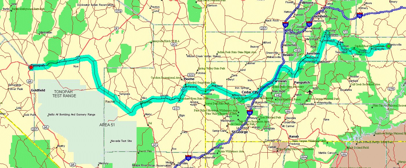
One of the first pictures of the day as we drive through Capitol Reef National Park. 
A photo of me out in this terrain. (From Shannon) 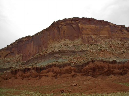
Cliffs in Capitol Reef National Park. (UPDATE: We would be back at this spot 18 years later with Gabe). (From Shannon) 
At 8385 ft above sea level in a very high mountain pass. Not as impressive as Colorado but still a highlight. 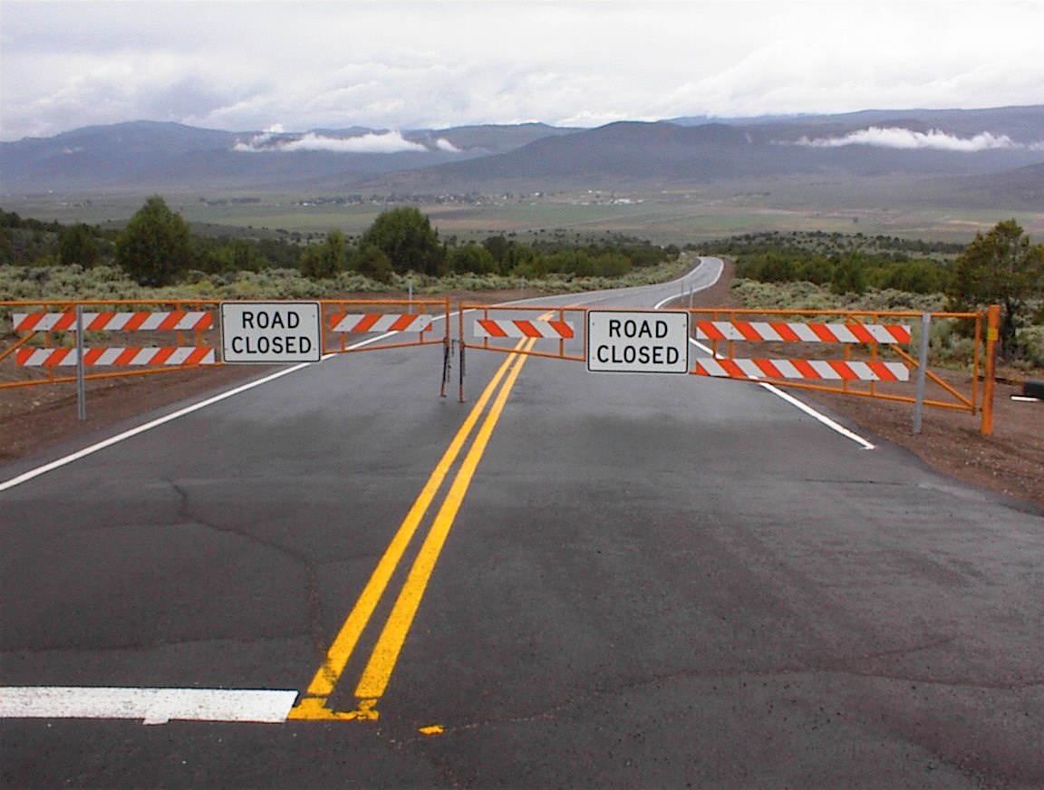
Barricaded road, Browns Lane going to Koosharem in the distance. I have no idea why it was closed as it was an easy 5 mile drive around it. 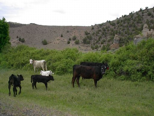
Utah cows, somewhere around Koosharem, Greenwich, or Kingston. (From Shannon) 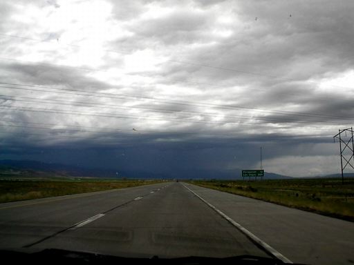
Monsoon storms near Cedar City as we prepare to head west again into Nevada. (From Shannon) 
Crossing the border from Utah into Nevada. It was fun getting to cross in such a remote place. 
Even in east Nevada there was some foliage and flowers. (From Shannon) 
Joshua trees along the road to Area 51. (From Shannon) 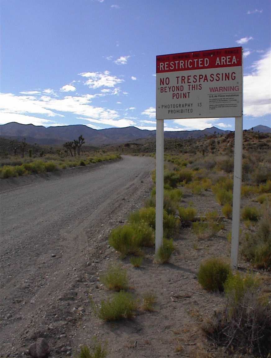
The boundary for Area 51. Word on the UFO groups was that when you crossed past this sign they would automatically call the Lincoln County deputies out. 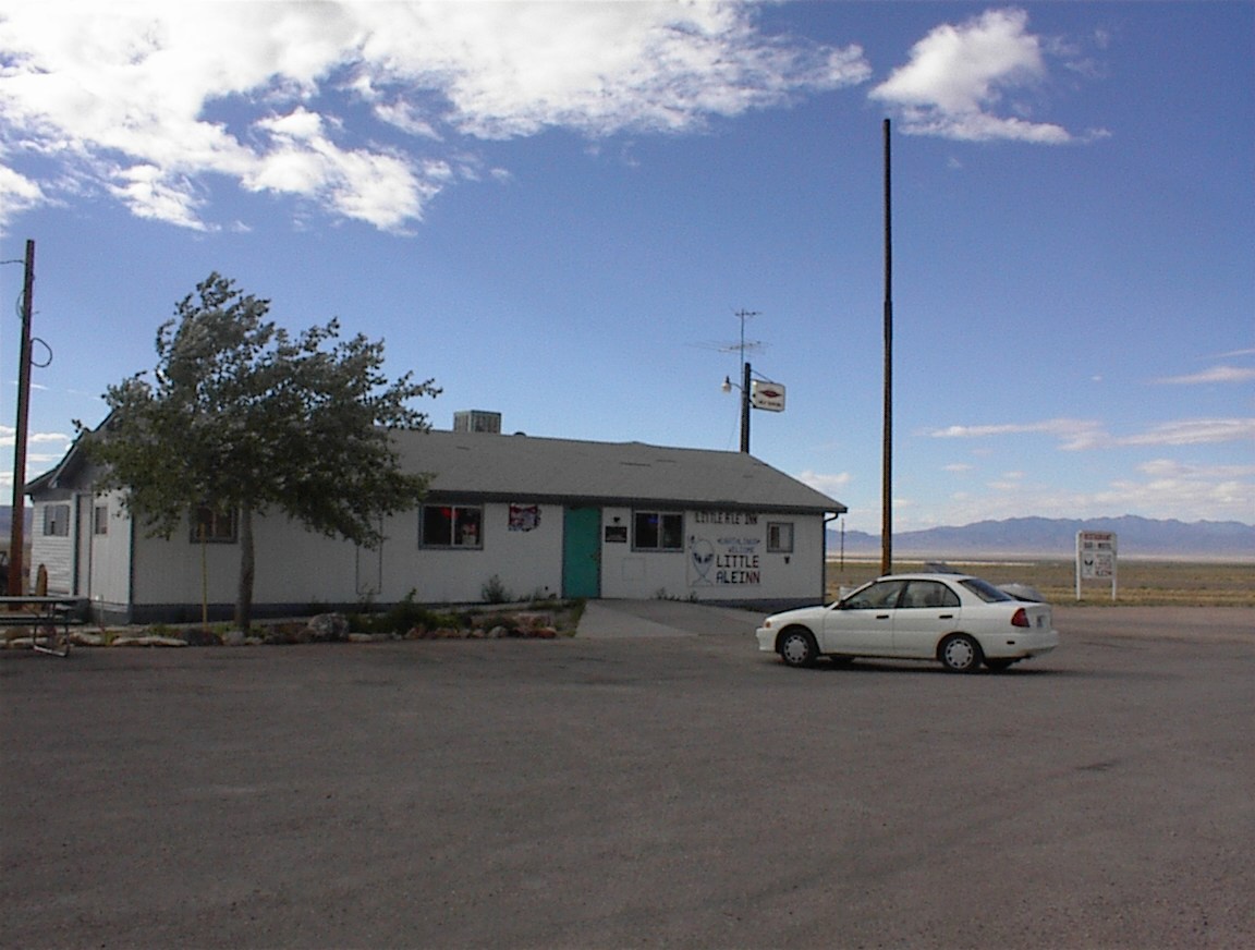
The famous Little Ale'Inn at Rachel. 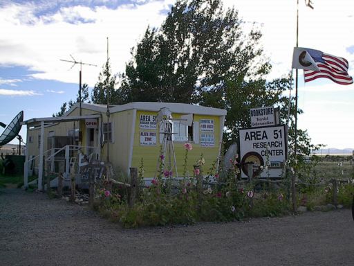
Area 51 Research Center at Rachel. (From Shannon) 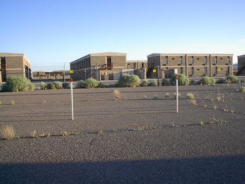
The dorms at Mancamp at Tonopah. I had originally kept the picture off the website but years later there's not really any harm in posting it. The dorms I lived in were in the distance past the last row of buildings. Each long building had a laundry room in the middle. Each room had a phone, cable TV, shower, AC/heater, and bathroom. 
The OK Corral Motel, our dubious stopping place in Tonopah, NV. 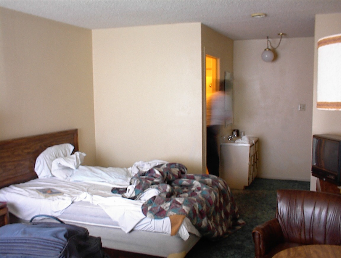
Luxurious accommodations at the hotel in Tonopah. I never thought I'd be back in Tonopah again. |
|